SpecConnect currently relies upon Google Satellite Map imagery to render its maps on both the SpecConnect portal and the FieldScout and WatchDog Mobile apps.
The frequency of updates to Google’s satellite imagery can vary depending on the location and other factors. In general, Google aims to update its satellite imagery every 1-3 years for areas where it is available. However, the actual update frequency can vary depending on a number of factors, such as the availability of new imagery, the level of demand for the area, and the resources available for updating the maps.
Some areas may be updated more frequently than others due to factors such as changes in land use, new construction, or natural disasters. In some cases, Google may also use third-party sources to supplement its own satellite imagery.
It’s important to note that Google Maps uses a combination of satellite imagery, aerial photography, and other data sources to create its maps. In addition to satellite imagery, Google may also use other sources to update its maps, such as street-level photography and user-contributed data.
Google does not typically announce when it will update its satellite imagery, as the update schedule can depend on a variety of factors that are subject to change. Some of these factors include:
- Availability of new imagery: Google relies on satellite providers to capture and provide the imagery that is used in Google Maps. The frequency of updates to the imagery can depend on the availability of new imagery from these providers.
- Quality of the imagery: The quality of the satellite imagery can also affect the frequency of updates. If the imagery is of high quality and provides detailed information, it may not need to be updated as frequently.
- Level of demand: The frequency of updates may also depend on the level of demand for a particular area. Areas with high levels of activity or development may be updated more frequently to ensure that the maps are accurate and up-to-date.
- Resources available: The frequency of updates can also depend on the resources that Google has available. Updating satellite imagery can be a resource-intensive process, and Google may prioritize updates based on the areas that are most in need of updates.
Overall, the frequency of updates to Google’s satellite imagery can vary based on a number of factors, and it’s important to keep in mind that the imagery may not always be completely up-to-date.
Please also note that the satellite imagery may look different at different zoom levels. When you zoom in or out on the maps, Google may use different imagery to display the area, depending on the level of detail required. This can result in differences in the quality or resolution of the imagery.
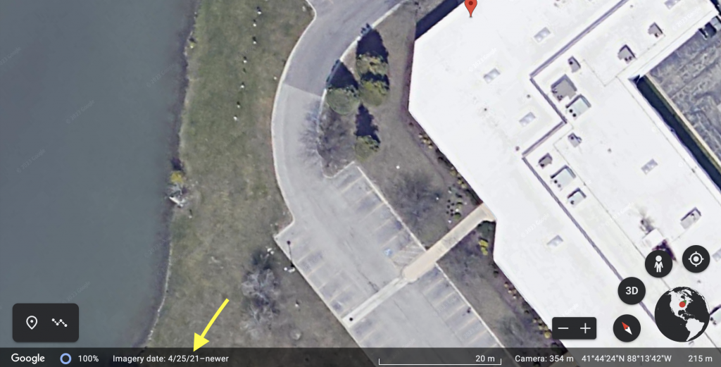
In most cases the satellite imagery available on SpecConnect is the same as that available on Google Earth (but not always). Launch Google Earth on your browser, turn off 3D imagery and navigate to any location of interest. In the bottom left corner you should see the date used to create the current satellite view.
The Google Earth Frequently Asked Questions web page may provide some additional helpful content that might also apply to the Google Maps API that we utilize in our products including how to recommend areas for imagery refresh.